
Offline-first safety and
decision-support
when it matters most.
trackaroo® is an adventure safety and decision-support platform for people travelling, working, or exploring in remote and low-signal environments. Built for when the signal drops — but your need for reliable information doesn't.
trackaroo® helps you answer what matters
Every feature in trackaroo® exists to help you answer these five practical questions — when it matters most, and when connectivity is limited.
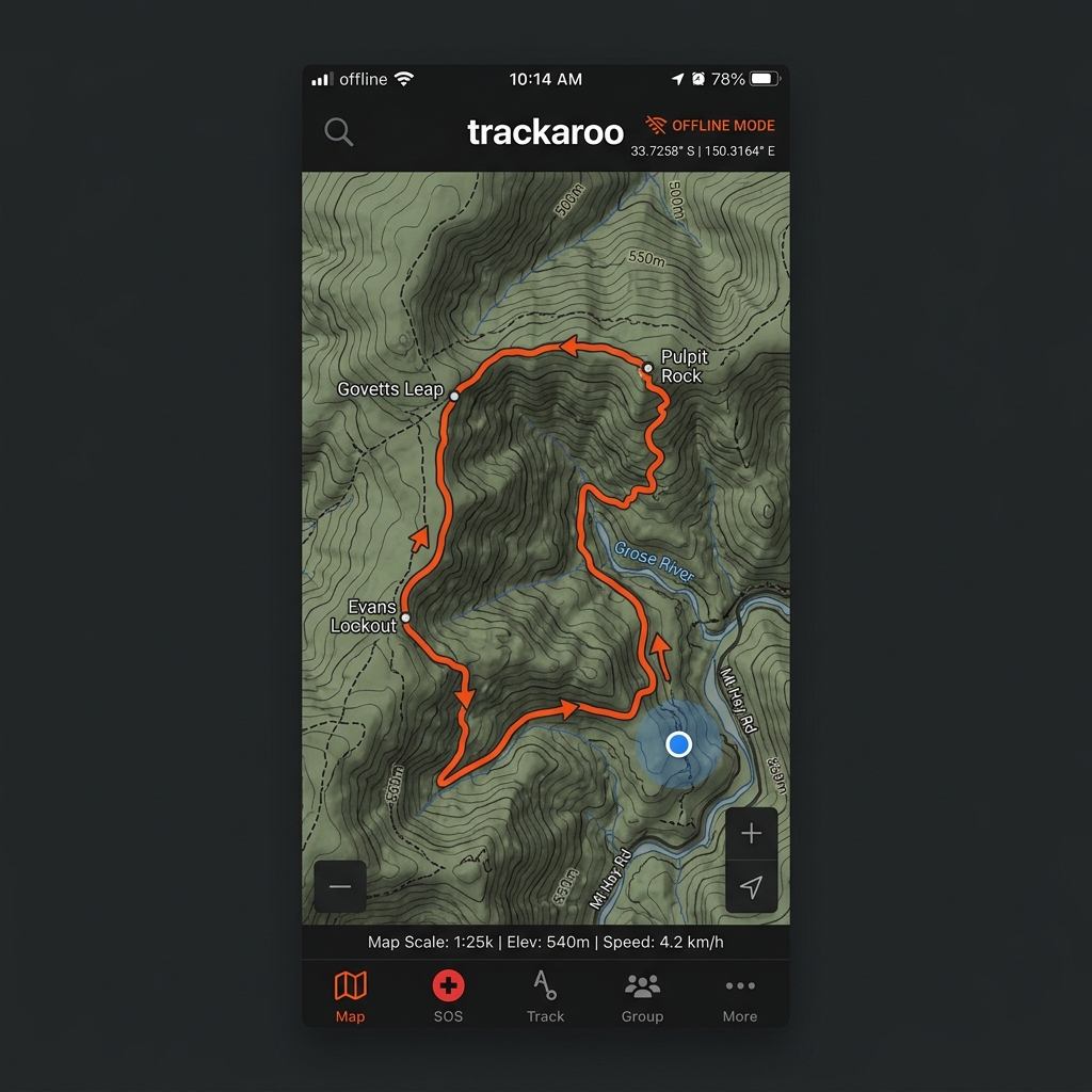
Where am I?
Pinpoint your location on detailed offline maps with confidence.
Where am I going?
Plan your route, view trip progress, and stay on track.
What surrounds me?
See hazard overlays, track conditions, and critical info about what's ahead.
How do I get back?
Retrace your exact steps with BackTrack™ — even offline.
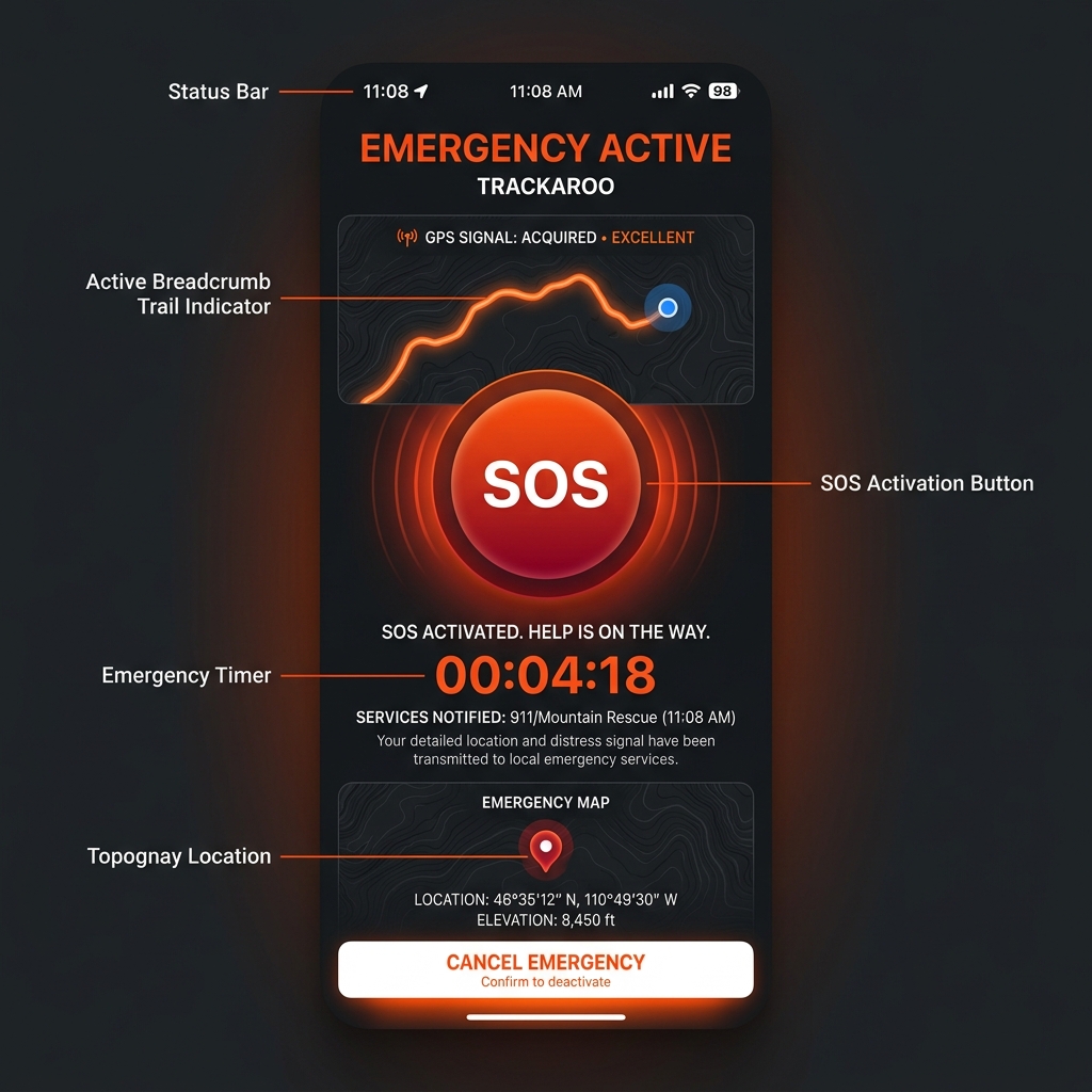
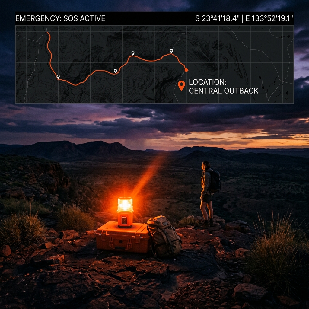
How do I call for help?
Trigger SOS in two taps. Log your emergency and stay prepared.
Built for when it matters
SOS Emergency Preparedness
Activate SOS in two taps from any screen. Your GPS coordinates are logged locally and instantly — fully offline. Calm, practical emergency support when you need it.

BackTrack™ Return Navigation
Breadcrumb-based return navigation. Always know how to find your way back.
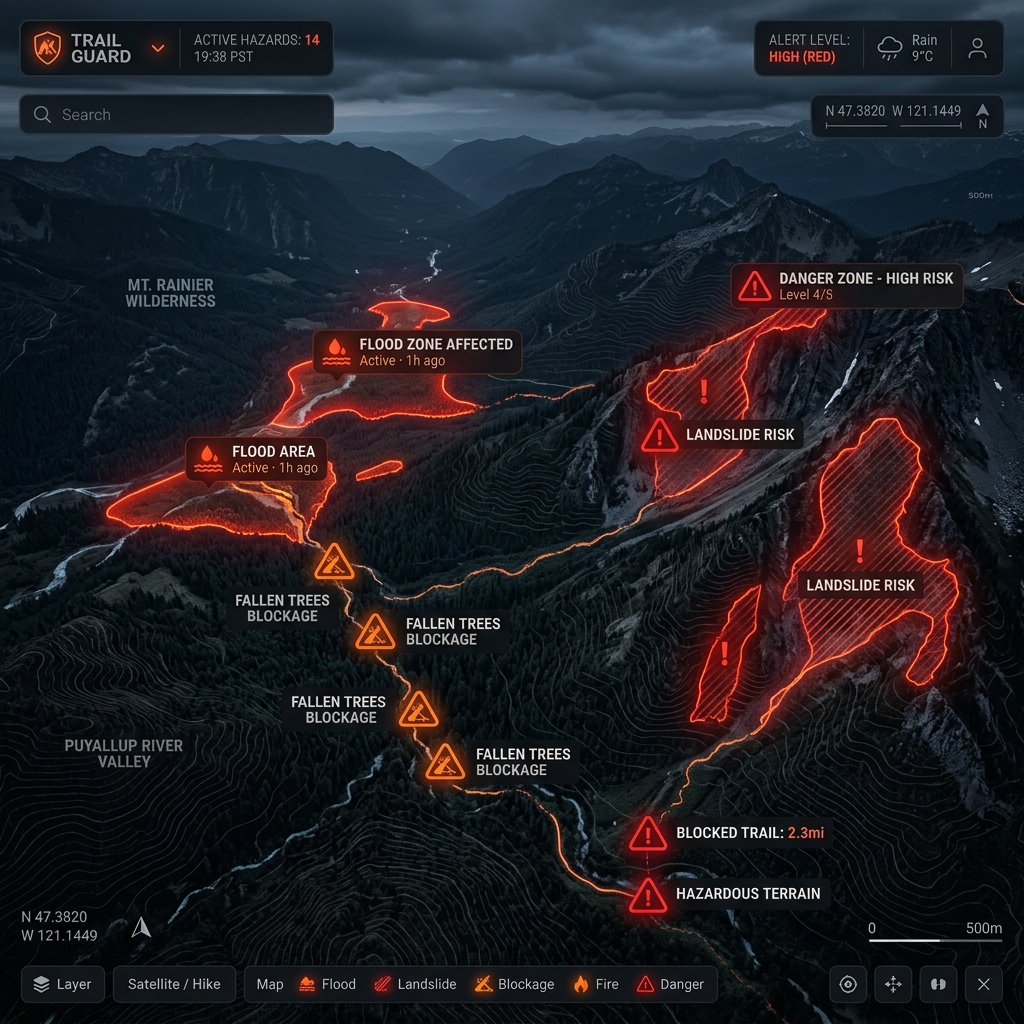
HazTrack™
HAZARD AWARENESS

TrackMate™
GROUP AWARENESS
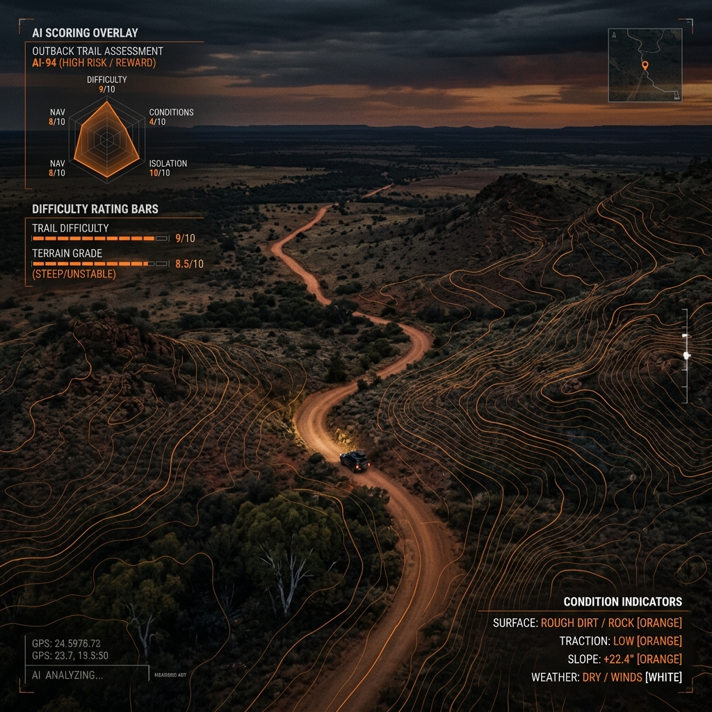
TrackIQ™
DIFFICULTY & CONDITIONS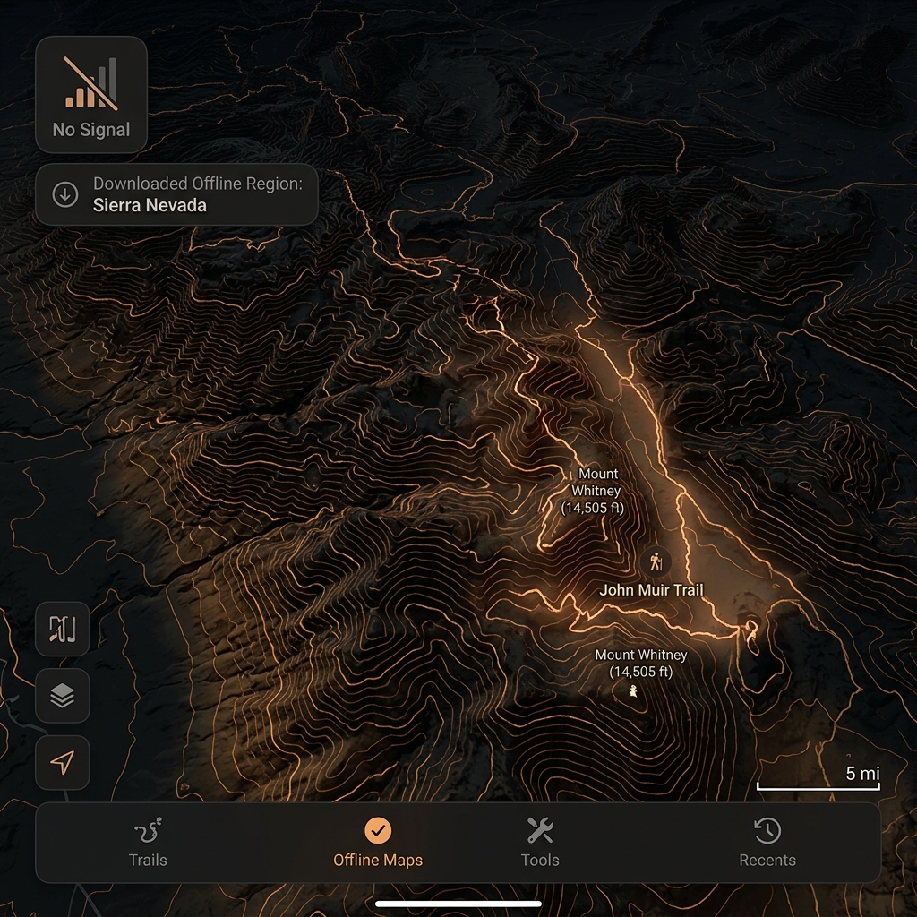
Offline Navigation
Pre-download detailed maps for confident navigation without network dependency.
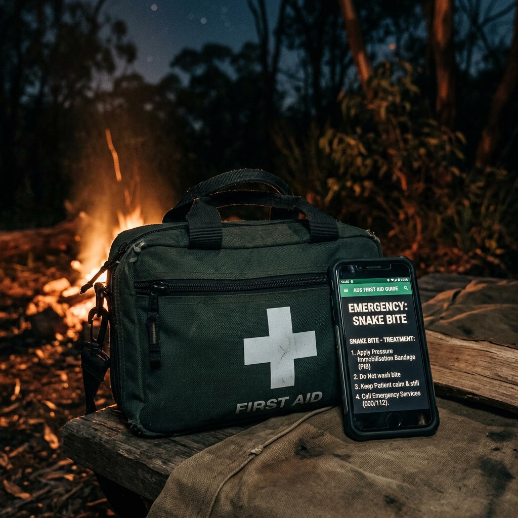
First Aid
REFERENCE
We all face the same challenges
Different equipment, different environments — but the same core challenges when you're in remote areas.
Limited Signal
No mobile or internet connection when you need it most.
Changing Conditions
Weather and terrain can change quickly and unexpectedly.
Route Uncertainty
Routes are dynamic. Plans change. Detours happen.
Hazard Awareness
Know what surrounds you and make informed decisions.
Decisions Without Signal
You need the right information to make decisions offline.
Download Maps.
Go Offline.
Stay Confident.
When signal drops to zero, trackaroo® keeps working. Pre-download topographic maps, hazard overlays, and safety data before you leave — then navigate with complete confidence, no network required.
Selective Map Downloads
Choose your region, download detailed topographic maps with trails, tracks, and elevation data. All stored securely on-device.
Pre-Cached Hazard Information
HazTrack™ overlays for fire zones, flood areas, and severe weather — all pre-loaded before you leave coverage. Updated each time you sync.
Privacy by Design
Your GPS logs, breadcrumbs, and personal data stay on your device. You own your data — always.
Built for diverse adventurers and professionals
trackaroo® is designed for a broad range of outdoor and remote-area users who rely on clarity, safety, and confidence when digital information becomes limited.

4WD Explorers & Remote Travellers
Navigate remote tracks with confidence. Plan trips, find camp spots, and stay aware of hazards and conditions.

Bushwalkers & Hikers
Stay on track, understand what's ahead, and confidently make decisions in the back country.

Mountain Bikers & Riders
Explore trails with ease. Know the difficulty, conditions, and your return route at all times.
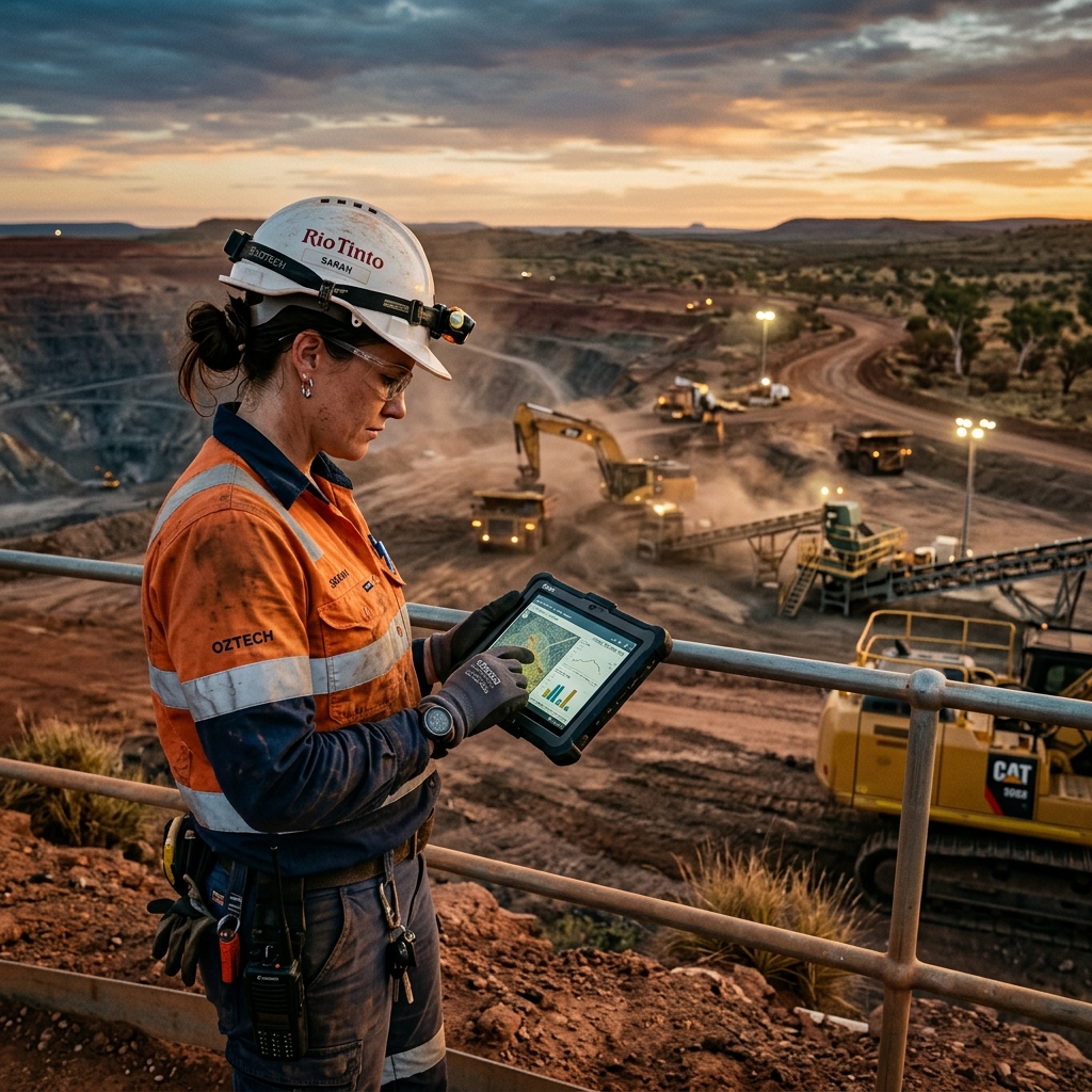
Remote Workers & Professionals
Reliable situational awareness, team connectivity, and safety tools for remote operations.

Fishers & Hunters
Find access points, understand land tenure, and stay aware of conditions and seasonal changes.

Snow & Alpine Users
Navigate snowfields, alpine terrain, and changing conditions with clarity and confidence.
"trackaroo® supports safer human decision-making for people travelling and operating in remote or low-signal outdoor environments, when digital information becomes limited or uncertain."
Honest about limits
trackaroo® has been designed with clear responsibility boundaries. We believe in providing practical support — not false promises.
This responsible positioning is important for industry partners, suppliers, land managers, emergency stakeholders, insurers, outdoor brands, and future commercial partners.
Does not claim to make outdoor activity safe
trackaroo® provides information, structure, and offline capability so users can make better-informed decisions.
Does not override official warnings or closures
Local knowledge, emergency services, and user judgement remain primary. trackaroo® supports, not replaces.
Does not guarantee rescue or connectivity
Emergency features are carefully framed and do not imply dispatch or rescue capability.
Clear data freshness and limitation messaging
Hazard and track information is presented with clear limits and freshness indicators so you know what you can trust.
Trackaroo's Got You.
Download trackaroo® and give yourself a more resilient digital companion — one that remains useful when reception drops, information becomes stale, and decisions matter.