Practical tools for when it matters most
Each capability exists to help you answer practical questions in the field — where you are, what surrounds you, how to get back, and how to stay connected with your group.
SOS Emergency Preparedness
"Calm, practical emergency support when you need it."
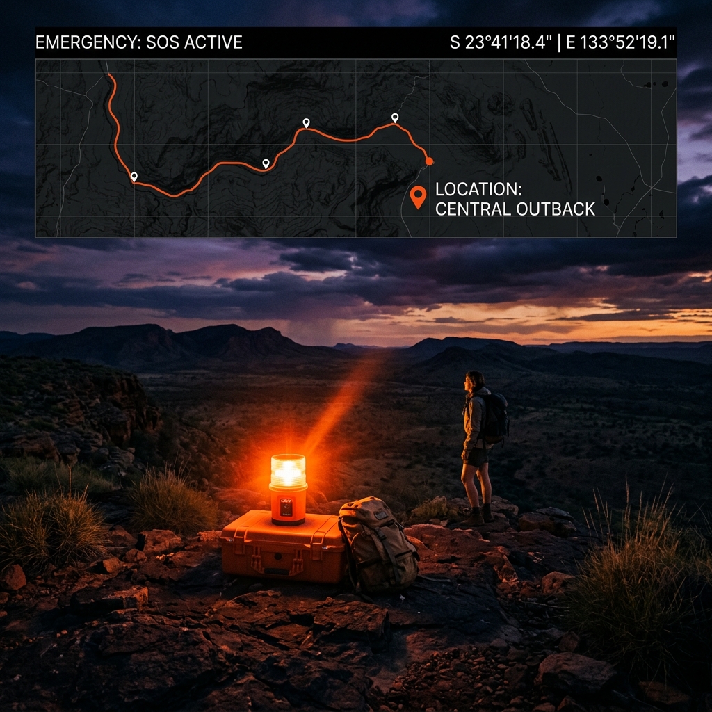
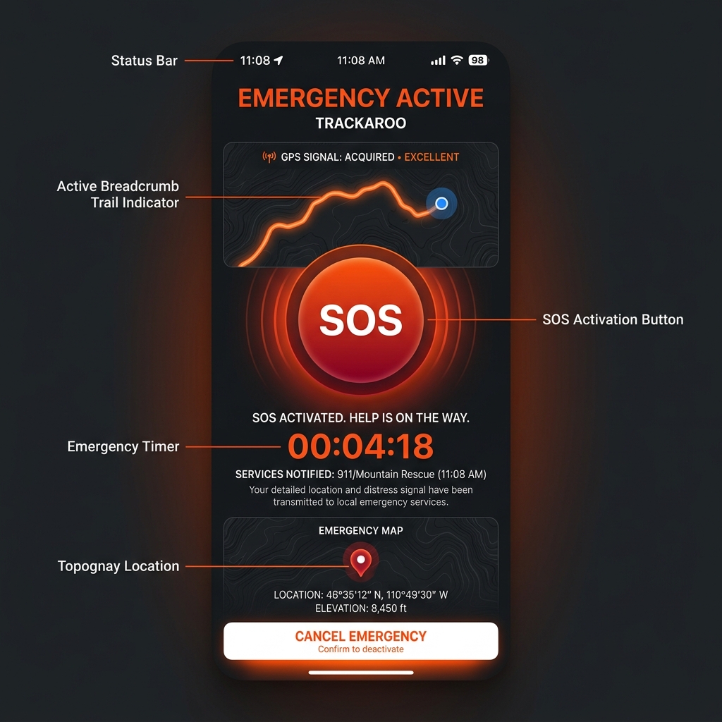
Activate SOS in two taps or fewer from any screen. Your GPS coordinates are logged locally and instantly — fully offline, no signal required. Emergency features are carefully framed and do not imply dispatch or rescue.
BackTrack™ Return Navigation
"Breadcrumb-based return navigation. Always know how to get back."

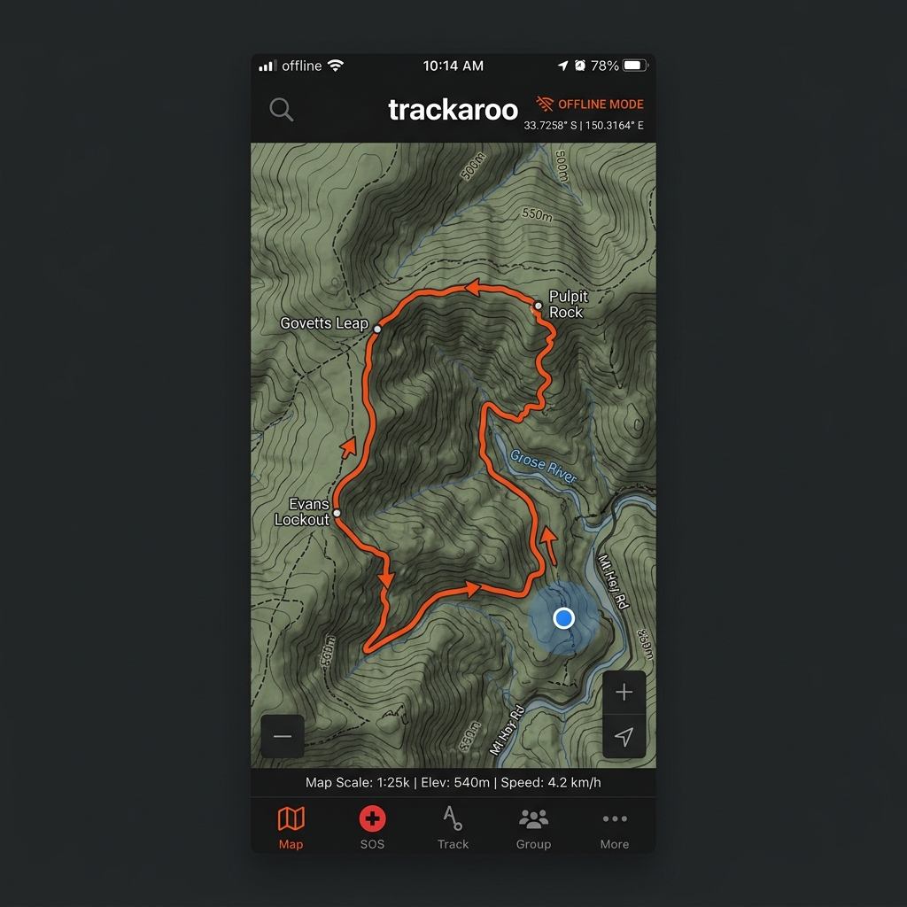
Automatic breadcrumb trail recording. Retrace your exact path when conditions change or you need to find your way back. Works entirely offline with on-device GPS.
HazTrack™ Hazard Awareness
"See what surrounds you and what's ahead."
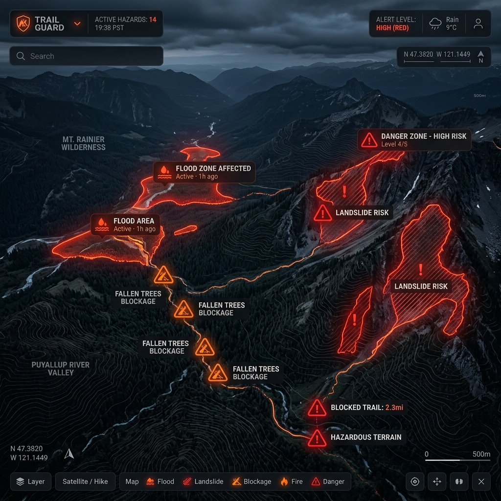
Pre-cached bushfire, flood, and severe weather information overlaid on your map. Hazard and track information is presented with clear limits and freshness indicators.
TrackMate™ Group Communication
"Stay together, stay aware. Practical group connectivity."
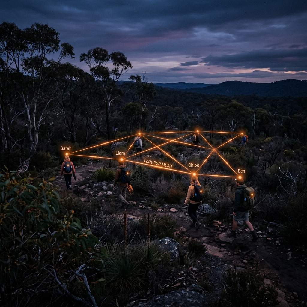
Peer-to-peer messaging and location sharing via Bluetooth LE and LoRa radio. Designed to support group awareness without becoming a monitoring or surveillance system.
TrackIQ™ Track & Route Context
"Understand track difficulty and conditions before you go."
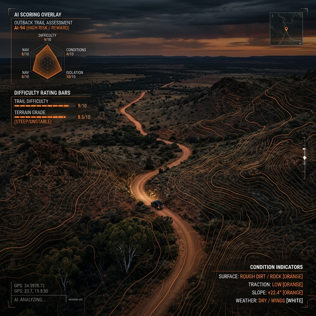
Track and route context including difficulty grading based on gradient, surface type, and elevation profile. Clear, practical information to help you plan and make informed decisions.
Offline Navigation
"Offline maps and navigation you can rely on."
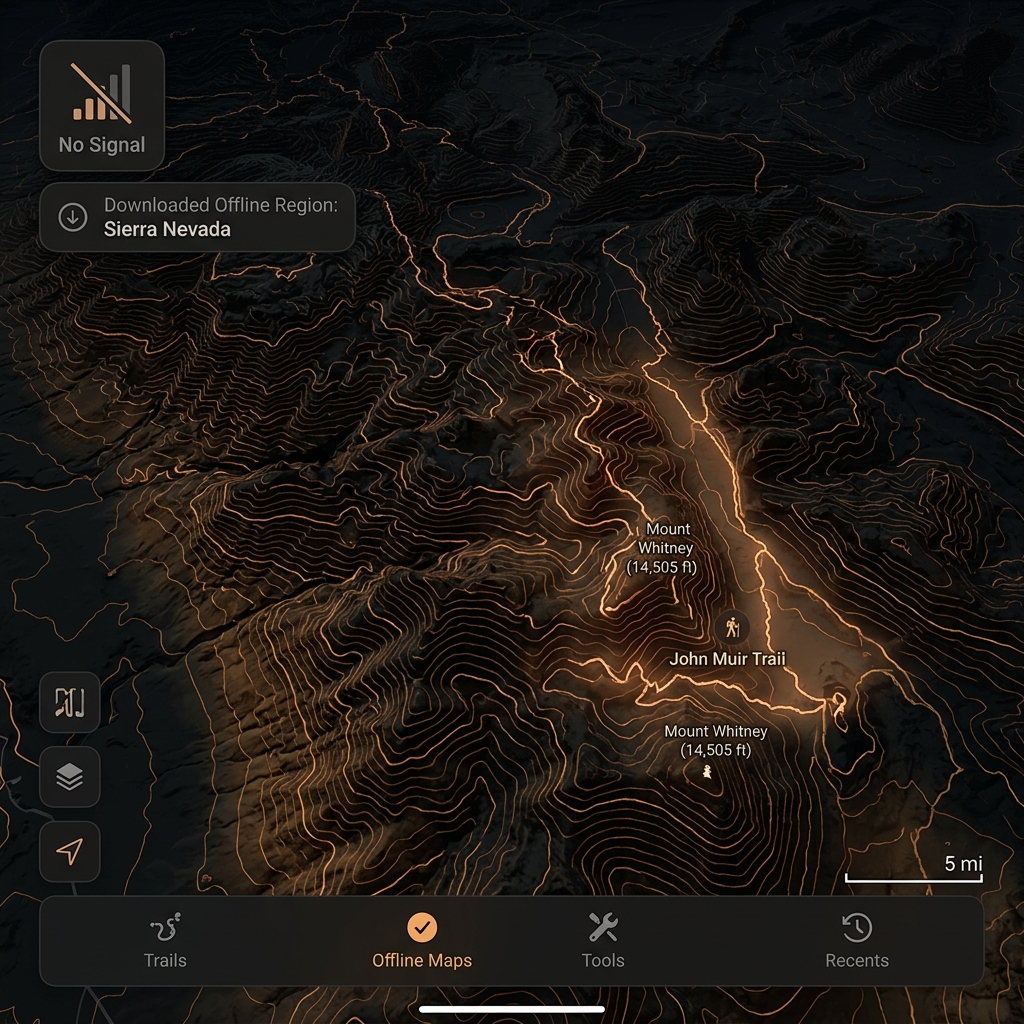
Pre-downloaded topographic maps with full GPS tracking. Navigate with confidence even in areas with zero cellular coverage. Offline-first design is central, not secondary.
First Aid Reference
"Practical reference content when you need it."
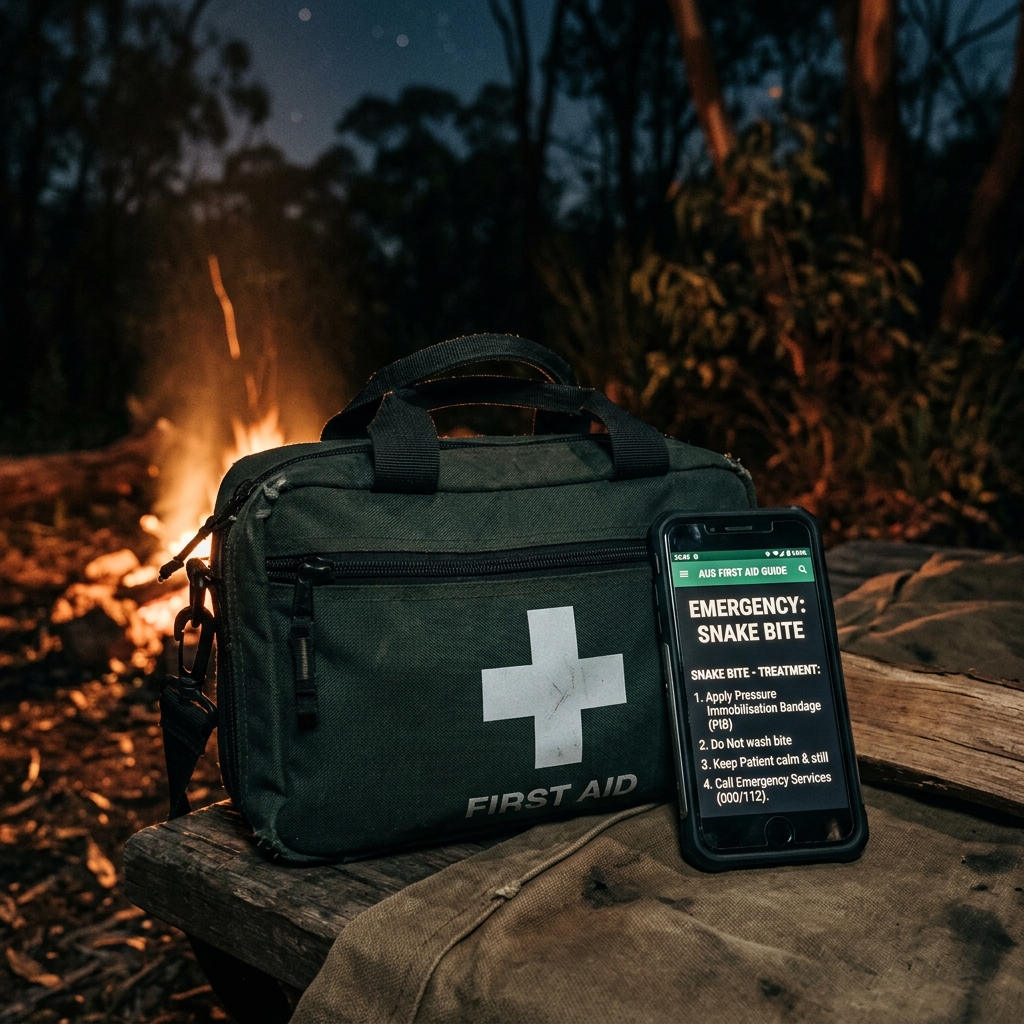
Offline-cached first aid reference guidance. Essential information available instantly without requiring a download in the field. Not a substitute for professional medical advice or formal training.
More than a navigation app
- close Requires cell signal for core features
- close Basic offline maps, no hazard data
- close No emergency communication
- close Social features over safety features
- close Generic — built for urban trails
- check_circle Offline-first design is central, not secondary
- check_circle Hazard awareness with clear freshness indicators
- check_circle Peer-to-peer group communication support
- check_circle Safety-first philosophy, not feature-first
- check_circle Built for diverse outdoor and remote-area users
Seven capabilities.
One app.
Total clarity.
Experience all seven capabilities. Download trackaroo® and give yourself a more resilient digital companion for remote and low-signal environments.